2.1.10 Geometry Editing
Using built-in GIS drawing tools, you can draw new features, apply line buffers, and generate land-use or building footprints without switching between separate utilities.
Here is how to create a land-use layout starting from basic road lines and a Site-Boundary:
- You can use an existing Site-Boundary or create one directly in Pantograf by clicking the Add Layer

button.
-
To adjust the radius of a polyline, click the specific vertex you wish to modify and enter your desired radius value (for example, 410).
-
Next, configure the Layer Symbology with as-filter if you need to exclude existing buildings from the basemap.
- Once the Site-Boundary is ready, create a new polyline layer by clicking the Add Layer
button.
-
Draw the network using your preferred polyline drawing tools.
-
Open Layer Symbology and select gg_line-buffer to set up the network buffer (used here to define road width).
-
Select your preferred treatment for intersections, choosing either Filleted or Chamfered.
-
Enable the Global Merge

button to merge all polylines and apply the chosen fillet or chamfer treatment to every intersection.
- To clip and segment the network for land-use, click
.. Then, from the Layer list, select the Site-Boundary layer.
- Click the button to verify that the correct Site-Boundary is selected.
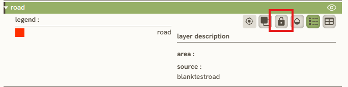
- The Site-Boundary will now be set as the Mask layer here:

.
-
Click Bake to Polygon.
-
In Bake Mode, select from the available options (explained below using our example):
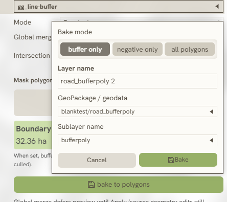
- **Buffer Only:** Bakes only the road polygon.

- **Negative Only:** Bakes only the land-use polygon.

- **All Polygons:** Bakes both the road and land-use polygons.
11. To split a feature into multiple parts, select Split Feature by clicking the Edit Feature Geometry

button.
Keywords
geometry, editing, draw, edit, vertices, snap, split, rotate, scale, polygon, line, point, geodata, collaborator, new, feature, 2 1 10